
Clemmons Neighbors: Block Sources
Public sources answer different block questions. The Forsyth County Tax Parcel Viewer shows the land around a known address. A linked Tax Administration property record can identify the recorded owner and distinguish a situs address from a mailing address. A deed or plat gives the recorded land description. Voter material is a separate, carefully limited confirmation source. Community links may identify an association, but they are not a list of everyone on a block.
| Source | What It Shows About a Block | Access |
|---|---|---|
| Tax Parcel Viewer | Parcel shape, parcel ID, road adjacency, map layers, and a selected spatial set | Public GIS, with selection, print, and export tools; not an occupant list |
| NCPTS tax record | Recorded owner, mailing and situs addresses, value, and parcel identifiers | Public property search; mailing address can differ from the parcel |
| Forsyth deeds and plats | Recorded parties, lots, easements, right-of-way, and prior transfers | Free index, with older images, books, or microfilm handled through the Register of Deeds |
| Voter-file request | Lawful county, precinct, or geographic voter fields, status, and history | Written request, actual cost plus a service charge up to $25; confidential fields stay withheld |
| Village and library sources | Road, public-project, association, and historical address context | Village maps, agendas, records request, North Carolina Room, and historical collections |
The owner on a parcel record is a land-record fact. It does not establish the people who live there, a social relationship between adjoining lots, or a complete group of Clemmons neighbors. Treat the property, voting, and historic layers as separate evidence with separate dates.
Clemmons Parcel Records by Block
The parcel viewer is the practical starting point for the immediate area around one address. Search by Official Address or REID, then confirm the selected parcel by its situs address, boundary shape, and a legal or subdivision clue. The viewer also supports Owner Name, Parcel Number, REID, and Block and Lot. When a normal address search fails, the documented help example uses a percent sign wildcard and omits the street type or abbreviation, such as 1022 % main st.
- Find the known parcel and save its REID or PIN, situs address, subdivision or lot, and legal description.
- Open Map Layers and the Legend, then zoom until parcel edges and road names can be read. Click each adjoining parcel or the parcel across the road. Use the multiple-feature triangle when more than one feature sits under a click.
- Use Draw or Measure to mark a block face or create a buffer. Select with a click, Shift to add, and Ctrl to remove, then review the resulting table before exporting any selected records.
- Open each linked property record, then compare its lot or legal description with the recorded deed or plat. Parcel adjacency is the boundary test, not a claim about a household.
For a longer route down a named road, the Clemmons street directory follows the address-to-deed chain without turning one small parcel cluster into a roster.
Clemmons Parcel Records: Tax Labels
Forsyth’s tax record keeps the situs or location address apart from the owner’s mailing address. The situs identifies the land or building. The mailing address is where tax correspondence goes, which can be a post office box, another street, or another state. Neither field proves that every person associated with a parcel is present there now.
- Parcel or PIN
- A county identifier for a particular piece of land. It is useful for matching the map, tax record, and deed trail.
- Situs address
- The physical location used to identify the parcel or building in the property system.
- Mailing address
- The address for tax correspondence. It should not be treated as the parcel’s location or a statement of occupancy.
- Plat
- A recorded map that shows lots, blocks, roads, and subdivision boundaries. It is stronger than a tax-map sketch for legal boundary details.
Use the Forsyth deed index after the parcel step. A recorded instrument can supply a lot number, subdivision, easement, or right-of-way description that remains useful when street addressing changes. For older material, the office holds books and microfilm even when an index entry lacks a digital image.
Note: Assessment dimensions can differ from legal dimensions, so verify a disputed line with a recorded plat or deed rather than the tax map alone.
Clemmons Association Records
The Village’s official quicklinks identify four neighborhood associations. That is useful for finding an organization’s own contact route or public notices. The Village page does not provide member rosters, board contacts, or a complete directory for any of them. A parcel owner should not be assumed to be an association member, and a resident should not be assumed to appear on a public association list.
| Officially listed association | What the Village link establishes | What was not located |
|---|---|---|
| Asbury Place | It is named in the Village HOA quicklinks. | No public member roster or complete contact directory. |
| Springfield Village | It is named in the Village HOA quicklinks. | No public member roster or complete contact directory. |
| Waterford | It is named in the Village HOA quicklinks. | No public member roster or complete contact directory. |
| Clemmons West | It is named in the Village HOA quicklinks. | No public member roster or complete contact directory. |
The Village’s neighborhood-association quicklinks show the official organization layer available for Clemmons residents.
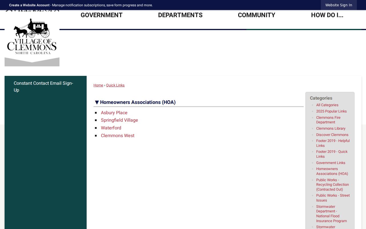
Use an organization’s own approved contact route for community questions. No verified public membership directory or umbrella roster was found in the Village materials.
Clemmons Voter Records by Block
The public North Carolina Voter Search is a name search, not a street-browse service. It asks for first and last name, with optional middle initial, year of birth, and county, plus a voter-status selection. A result may show public address, party, precinct or district information, status, and voter history. It never shows ballot choices, and a no-match does not prove a person was never registered.
A block-scale request follows a different route. Under N.C.G.S. 163-82.10 and 163-82.13, county or precinct lists and selective lists may be requested in writing through Forsyth Elections voter-data resources. State the geographic scope, fields or format sought, and delivery medium. Actual cost and a service charge up to $25 may apply. The request does not make confidential data public, and it should not be presented as a one-click list of every voter on a block.
Forsyth Elections is at 201 N Chestnut Street, Winston-Salem, NC 27101, with procedure and file questions handled at 336-703-2800. The research identifies phone, in-person, and written-request routes in addition to the online name search. Protected addresses, full dates of birth, Social Security numbers, email, identification material, and ballot choices remain outside the public result.
Clemmons Civic Records in Agendas
Public meeting material can add civic context to a block without identifying a household list. The Clemmons agenda center offers date-range, keyword, and category controls for Village Council, Planning Board, and Zoning Board packets. An attachment may contain an applicant name, parcel reference, development plan, or staff report. It still needs to be read as a document about that public matter, not as a current-resident statement.
The Clemmons agenda archive is the source shown in this captured view.
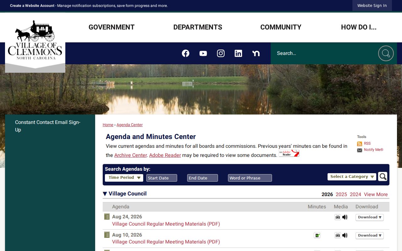
Search a road name, development name, date range, or board category to date a public project around a parcel. The documents may have privacy limits that depend on the particular record.
For an address-specific permit, inspection, code, or correspondence file that is not online, use the Village records-access instructions and the public-record request form. Include the address, date range, likely department, and document type, then choose whether to view records or receive copies. Email, mail, fax, and in-person follow-up are documented alternatives; the OpenGov permit application was temporarily inaccessible during the research inspection.
The Clemmons public-record request form provides the documented fallback for a non-indexed municipal file.
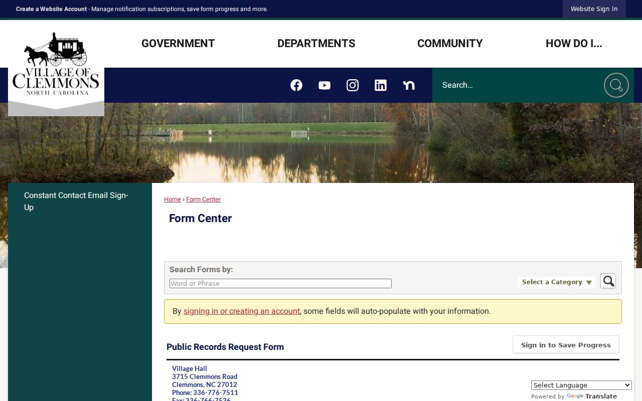
The form asks for a focused description and tracks a request through review. It lists copy charges of $0.10 for a single-sided 8.5 by 11 page and $0.20 for a double-sided page, with separate rolled-plan charges.
Clemmonsville Block Records
Older block research can run into a place-name problem. Clemmons began as Clemmonsville, and historical directories may organize an address under Winston-Salem, Forsyth County, a rural post office, or another nearby community rather than today’s Village label. An earlier address search therefore needs the road, parcel description, and alternate community names beside the modern address.
The Forsyth County Public Library North Carolina Room is the documented historical fallback. Its directory material, newspaper index, microfilm, photographs, and vertical files can provide dated context. DigitalNC and the Clemmons Historical Society collection add community-history material. These sources can show an earlier address snapshot, but rural coverage and omissions remain possible.
Note: A historical directory entry is dated evidence, not a current block list or a substitute for the parcel record.
Clemmons Block Tools Compared
Official sources preserve the connection between a claim and the office that created it. Commercial neighbor-lookup services may blend public records with purchased data and inferred matches. That can be convenient, but it is not the same as a county record and should never replace a source check.
| Official source | Commercial neighbor-lookup category | Best use |
|---|---|---|
| Tax record or deed | May combine old public and purchased data | Use the official record to verify ownership, document date, and parcel. |
| Parcel viewer | May draw an approximate map relationship | Use county GIS to confirm parcel geometry and adjoining land. |
| Election request | May present a guessed address match | Use the lawful county or state route for the actual public fields and restrictions. |
Official records can also be incomplete, dated, or limited by law. Keep the access date, record type, and custodian with every note, then verify an important fact directly with the office.
Mapping a Clemmons Block
Move outward from a confirmed parcel, not from a generalized search result. The map-to-record flow is address to parcel, parcel to tax record, tax record to deed or plat, then public civic or historical context. Each step answers a narrower question than the last, and none converts adjoining ownership into a statement about a private household.
The viewer can print a map-only image or a report and can export up to 1,000 selected records. A printout is most useful when it records the source date, selected parcel IDs, and the exact map layer used. For a legal lot line, easement, or road right-of-way, return to the deed or recorded plat rather than relying on a screen image.
Privacy Limits for Clemmons Records
Parcel records do not reveal every household member, guest, utility customer, mail recipient, or person who has never appeared in a public filing. North Carolina’s Address Confidentiality Program, Chapter 15C, protects the actual address and telephone information of qualifying participants. Voter and court records also have statutory exceptions, and the federal Driver’s Privacy Protection Act restricts motor-vehicle information.
N.C.G.S. Chapter 132 allows access to public records while requiring protection of sensitive material. N.C.G.S. 132-1.10 covers redaction of identifiers such as Social Security numbers, driver-license or state-ID numbers, passport numbers, account data, and passwords. Report a possible sensitive-identifier image to the Forsyth County Register of Deeds rather than copying or sharing it.
Lawful use. Clemmons block research can support personal neighborhood curiosity, reconnecting with a community, or understanding a parcel. It must never be used to stalk, harass, intimidate, impersonate, or expose a protected address.